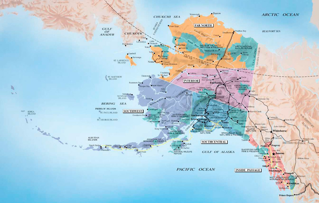
Moscow and Washington in the Arctic
The Coast Guard Cutter Healy breaks ice
for the Russian tanker Renda(R) near the
city of Nome Alaska on January 14, 2012
(no votes) |
(0 votes) |
The end of the “reset” policy proclaimed by the media in spring 2012 has raised the question of future Russian-US relations. Experts are not yet talking about a return to confrontation. However, relations between the Kremlin and the White House are witnessing a stirring up of long-standing disputes over issues from missile defense to conflict management in the former Soviet Union. Territorial conflicts between Russia and the United States are especially dangerous.
The end of the “reset” policy proclaimed by the media in spring 2012 has raised the question of future Russian-US relations. Experts are not yet talking about a return to confrontation. However, relations between the Kremlin and the White House are witnessing a stirring up of long-standing disputes over issues from missile defense to conflict management in the former Soviet Union. Territorial conflicts between Russia and the United States are especially dangerous.
At present, the sides have two disputed regions: the Bering Sea and the Arctic area. Cooperative projects on developing the Arctic have failed [1], and territorial rivalry between Moscow and Washington has come to the fore. The situation is complicated by three factors. First, the debate about repartition of the Arctic is among the five Arctic nations, four of them are NATO members. Secondly, quasi-ecological concepts are regarded in Washington as a tool for internationalization of the Arctic Ocean and, consequently, reducing the water area of the Russian Northern Fleet. Thirdly, the Arctic disputes are related to discussions on the prospects of Russian and U.S. strategic nuclear forces, especially submarine-launched ballistic missiles (SLBMs). In this sense, the role of the Arctic region in bilateral relations between Russia and the United States will increase.
How did They Divide the Arctic?
The Arctic was poorly studied until the middle of the XIXth century. The situation changed after the expeditions by the Austrian arctic explorer Julius Payer in the 1870s [2], when Austria and Hungary put forward their claims to a number of Arctic territories. Sweden and Norway voiced similar claims after the expeditions of Nils Adolf Erik Nordenskiöld (1878–1879) and Fridtjof Nansen (1890) respectively. There then came up projects on dividing the Arctic between the great powers along the lines of Africa and Asia. That was how “the first race for the Arctic” began in which the Russian Empire and the United States actively participated.
The Russian Empire developed the coast of the Arctic Ocean starting from the Middle Ages. Expeditions by Vitus Bering (1740–1742) and Stepan Krasheninnikov (1737–1740) allowed establishing the boundary between Eurasia and North America. At the beginning of the XIXth century, Russian arctic explorers Yakov Sannikov, Matvey Gedenschtrom, and Pyotr Anjou, explored the eastern coast of the Arctic Ocean. On February 16 (28), 1825, the Convention Between Great Britain and Russia on the division of lands between the two countries in North America was signed in Saint Petersburg (). The document became the first international legal instrument, identifying the north-eastern borders of Russia.
The United States initially did not have access to the Arctic Ocean. The first interest in Arctic issues was shown by the administration of John Adams (1825–1829), who saw the Convention Between Great Britain and Russia of 1825 as a risk for the “Monroe Doctrine”. The situation changed in 1867 when the U.S. purchased Alaska and the Aleutian Islands from the Russian Empire. According to the bilateral agreement of March 18 (30), 1867, the Russian-US border passed through the center of the Bering Strait, separating Krusenstern (Ignaluk) Island from the Ratmanov (Nunarbuk) Island on an equal distance. Further, the border was directed “in its prolongation as far as the Frozen ocean”.
The situation about this “line” was interpreted broadly in Washington. The expeditions of American explorers Adolphus Greely (1879) and George W. De Long (1879–1881) opened the Jeannette Island, Henrietta Island, and Bennett Island – which are part of the De Long Archipelago – to the north of the New Siberian Islands. In 1882, American expedition of John Dannhauer explored the mouth of the Lena River. This prompted the government of Alexander III (1881–1894) to increase attention to the Arctic. In St. Petersburg, it was feared that through this hypothetical land north of the New Siberian Islands and the De Long Archipelago (designated as “Sannikov Land” in Russian maps), the United States will reach the North Pole before Russia. In 1885, 1893 and 1899–1903, Russian arctic explorer Eduard Toll organized expeditions to search for this land. Nevertheless, Alexander Kolchak’s expedition (1903) and the Soviet Arctic Expedition (1935–1937) proved there is no large land north of the De Long Archipelago. Perhaps such land existed in the past, but collapsed due to the melting of the fossil ice, which was its base.
The Republican administration of William McKinley (1897–1901) proclaimed the Great Arctic Strategy. Its objectives consisted of attaching territories adjoining Alaska to the U.S., discovery of new Arctic lands and reaching the North Pole (). This strategy enjoyed the support of the next U.S. president – Theodore Roosevelt (1901–1909). In 1903, Anthony Fiala’s expedition left for the North Pole, but could not pass the Franz Josef Land. In 1908–1909, American arctic explorers Ferdinand Cook and Robert Peary independently of each other announced they have reached the North Pole.
The Russian Empire responded by developing the Northern Sea Route (NSR) [3]. After defeat at the Russian-Japanese War of 1904–1905, the government of Nicholas II (1894–1917) considered the NSR as an alternative route for the movement of fleet from the Baltic Sea to the Far East. Interest in the NSR increased in 1909 when Canada announced its ownership of all the lands and islands to the west of Greenland, between Canada and the North Pole. In connection with this, the Ministry of Marine organized the expedition of Georgy Sedov (1912–1914) and Boris Vilkitsky (1914–1915), who described the NSR. In 1916, Russia announced its ownership of all the lands that are extensions to the north of the Siberian continental plateau.
In the mid-1920s, there was a system of sectoral division of the Arctic [4]. In 1925, Canada, after a conflict with the Soviet Union on the Wrangel Island, announced that all the lands and islands to the north of the Canadian mainland fell under its jurisdiction. In 1926, the Presidium of the Central Executive Committee of the Soviet Union passed a resolution that “all the lands and islands, both discovered and which may be discovered in the future, located in that sector, are the territory of the Soviet Union”. The Soviet sector started including the territory between 32°04’35” E and 168°49’30” W, Canadian sector – the territory between 60° and 141° W. Other states received smaller areas. In 1933, Denmark announced that its Arctic sector, created based on Greenland, will include the area between 60° and 10° W. In 1934, Norway announced the creation of its Arctic sector between 5° and 35° E.
The United States received the smallest sector of the Arctic – between 170° and 141° W. In 1924, the United States Secretary of the Navy, Edwin Denby, proposed that activities in the waters of the Beaufort Sea, Bering Sea, and Chukchi Sea be intensified, while in the future – join the North Pole [5]. However, the administration of John Calvin Coolidge (1923–1929) did not support “Denby’s plan”. From late 1920s, Washington did not recognize the sectoral division of the Arctic, but did not dispute its validity.
Militarization of the Arctic
The U.S. interest in Arctic issues increased after the Murmansk Treaty (2010) came into force. American experts saw the treaty as Russia’s willingness to compromise in territorial disputes.
During the Second World War, Soviet and American leaders realized the military importance of the Arctic. In April 9, 1940, Germany occupied Denmark, and hence the question of Greenland arose. The administration of Franklin Roosevelt (1933–1945) feared that the Reich would try to use Greenland as a base for air raids on the United States. In connection with this, on April 9, 1941, the White House signed with the Ambassador of Denmark to the United States, Henrik Kauffmann, the agreement that allowed the U.S. Air Force to use bases in Greenland. In April 1941, the American military contingent was planted on the island. The U.S. right to use Greenland for military purposes was confirmed by a bilateral agreement in 1951.
Soviet Union also saw the Arctic as a potential theater of military operations [6]. Even before the war, the Northern Flotilla (1933) was set up first, and then the Northern Fleet (1937). In 1937, Soviet pilots Valery Chkalov, Georgy Baydukov, and Alexander Belyakov made a non-stop flight on the ANT-25 aircraft from Moscow over the North Pole to Vancouver (USA). This proved the theoretical possibility of the use of Soviet and American long-range aircraft to hit targets on each other’s territory. During the war, the Soviet Northern Fleet led military operations in the Barents Sea on the protection of convoys of allies. In August 1942, the Northern Fleet was able to disrupt Operation Wunderland – an attempt by the German heavy cruiser Admiral Scheer to break into the Kara Sea.
The Arctic policy of the Soviet Union intensified during the bipolar confrontation. The Soviet Northern Fleet received nuclear-powered missile and attack submarines, missile-carrying and anti-submarine aircrafts, missiles, aircraft carriers and anti-submarine ships. Apart from Severodvinsk (Arkhangelsk Oblast), seven naval bases were created: Polarny, Olenya Bay, Gadzhiyevo, Yagelnaya, Ura Bay, Ara Bay, Bolshaya Lopatka (Lisya Guba, Gremikha). Four naval bases for long-range aircrafts and aircrafts of the Soviet Navy (Kipelovo, Olenegorsk, Severomorsk-1, Severomorsk-3) were deployed. Military airfield Graham Bell was created at the Franz Josef Land, while a nuclear test site – at the New Earth. At the circumpolar zone, the USSR placed components of missile warning system (MWS): Olenegorsk Radar Station (“Dnepr/Daugava” type radar system) and Pechora Radar Station (“Daryal” type radar). Anti-aircraft missile battalions were deployed from the Chukotka Peninsula to the Kola Peninsula.
The United States had no large surface ships in the Arctic Ocean. The Pentagon created a limited infrastructure in the subarctic region. American combined-arms base (6-8 thousand troops) was established in the Canadian town of Churchill (Hudson Bay). The 11th Air Force of the United States Air Force was placed in Alaska. U.S. airbases Thule (Greenland) and Keflavík (Iceland) were opened for the needs of the 3rd and 17th Air Forces. From 1958, the United States and Canada created the North American Aerospace Defense. The United States Navy did not have regional command. Submarines and light surface ships of the Second Fleet (Norfolk Base in Virginia) and the Third Fleet (San Diego Base in California) came to the Arctic. In the Arctic Ocean, trips were made to the strategic missile bases of King Bay and Bangor (Washington). Components of the anti-submarine warfare SOSUS (SOund SUrveillance System) were deployed in the Arctic territories of the United States, Norway, and Canada.
In 1948, Soviet transport aircrafts Li-2 landed the expedition of Pavel Gordienko and Alexander Kuznetsov on the North Pole. The U.S. side considered this fact unproven. In 1952, C-47 transport aircraft delivered the American expedition of Joseph Fletcher and William Benedict to the North Pole. From 1909, Canada also staked its claims on the North Pole. The International Court of Arbitration ruled that in hundred years time, the North Pole could be taken by Canada if, within that period, no other country proved its right of possession of the territory.
Disputes over ownership of the North Pole were accompanied by demonstrations of power. In 1959, the American submarine Nautilus surfaced on the North Pole. In 1963, a similar action was carried out by the Soviet submarine K-181. In 1968, American polar explorers, Ralph Plaisted and Gerry Pitzl, and the French scientist Jean-Luc Bombardier reached the North Pole by snowmobile. In response, in 1977, the Soviet Union organized an expedition to the North Pole on nuclear powered icebreaker Arktika. These expeditions were intended to prove the possibility of landing specially trained airborne units on the North Pole.
Against this background, territorial disputes between the USSR and the U.S. began to be revived. On April 27, 1965, the Soviet Union declared the Kara Strait, Yugorsky Strait, Matochkin Strait, Vilkitsky Strait, Shokalsky Strait, and the Krasnoyarmyy Strait as its territorial waters, while the Dmitry Laptev Strait and Sannikov Strait – its historic waters. The United States Department of State declared its non-recognition of the Soviet claims. The United States, with the support of Sweden and Norway, insisted on the right of free entering of commercial ships into Soviet ports in the eastern part of the NSR, but the Soviet Union did not consider these demands as legitimate.
In 1979, the Supreme Soviet of the Soviet Union decided to move the eastern boundary of the Eurasian and North American continents to the west to 168°58’ W. This decision caused a territorial dispute between the Soviet Union and the United States because of the offshore areas in the Bering Sea and Chukchi Sea. On June 01, 1990, the sides signed an agreement under which the disputed territory of 50 km2 was transferred to the United States. The U.S. Congress ratified the agreement on September 18, 1990. No ratification took place in the USSR and in the Russian Federation. Washington does not recognize Russian claims, while Russia does not consider the agreement to have come into force.
The conflict over the border demarcation in the Bering Sea created a precedent of rivalry between the USSR and the U.S. in subarctic territories. Between the countries, there was no clear separation of offshore areas in the Bering Strait, and the state border along the Chukchi Sea was not detailed. In 1924, the United States recognized the Soviet Union’s territorial claims over the Wrangel Island, but did not recognize the 1935 identification of the East-Siberian Sea as a separate ocean space and its status of a territorial sea of the USSR. Theoretically, this allows the United States to raise the question of the right of entry of vessels into the waters of the East Siberian Sea, including the Wrangel Island.
“Transformed Rivalry”
The military factor in the Arctic acquired a new dimension during the implementation of the Soviet-American START-1 treaty (1991). A document envisaged the reduction of strategic nuclear weapons to 6,500 warheads by each side. The United States helped Russia in its implementation. On November 25, 1991, Washington initiated the Cooperative Threat Reduction Program, also known as the Nunn-Lugar Program. On June 17, 1992, Presidents Boris Yeltsin and George H. W. Bush signed an agreement to launch it. On October 11, 1993, the U.S. Congress passed the Cooperative Threat Reduction Act.
Of particular importance was the question of assisting Russia in dismantling nuclear-powered submarines of the Northern Fleet. Under the terms of START-1, Russia undertook to dismantle about 150 nuclear submarines by the end of 1996: 90 nuclear submarines – in the Northern Fleet and 60 – in the Pacific Fleet (later the deadline was extended to 2001, then to 2006). By the end of the 1980s, spent nuclear fuel (SNF) discharged from submarine reactors was sent to the Mayak enterprise for reprocessing. However, in 1992 Gosatomnadzor (Russian Federal Inspectorate for Nuclear and Radiation Safety) banned the transportation of spent nuclear fuel in old TK-11 and TK-12 containers, allowing transportation only in the new TUK-18 containers. In 1993, the Russian government commission concluded that Mayak lacked sufficient capacity to dispose spent nuclear fuel from submarines, and that shipyards could not cope with this task [7].
The United States assisted Russia on dismantling nuclear submarines in two directions [8]. First, it was the Cooperative Threat Reduction Program itself. Under this program, the shipyard Nerpa (Snezhnogorsk, Murmansk Oblast) and the enterprise Zvezdochka (Severodvinsk, Arkhangelsk Oblast) were modernized. The second – the program of Physical Protection, Control, and Accounting of Nuclear Materials launched in 1993. The United States Department of Energy supplied Russia with technologies, which helped in protecting more than 38 thousand fuel rods discharged from the nuclear submarine in the North and the Far East. Storage facilities for fresh fuel for nuclear submarines were enlarged.
Washington attracted the Scandinavian countries to the Cooperative Threat Reduction Program. September 26, 1996 saw the launching of a trilateral Russian-US-Norwegian Program on disposal of liquid radioactive waste – Arctic Military Environmental Cooperation. On May 07, 2001, Russia and Norway agreed to cooperate in the rehabilitation of Andreev Bay area (Severodvinsk). Norway helped Russia to build interim storage facilities for spent nuclear fuel at the Kola Peninsula and the enterprise for its disposal on the floating maintenance base Lepse.

Cooperation with Finland was more difficult. In 1996, the Ministry of Foreign Affairs of Finland allocated USD 700,000 to the Finnish company IVO for the treatment of liquid radioactive waste at the Atomflot plant. The Finnish radioactive waste processing company Nures was hired for the implementation of the project. However, Finland stopped funding the project in August 1997.
Sweden’s participation was smaller. In 1997, the Swedish consortium Industrial Group signed an agreement with the Russian National Design and Scientific Research Institute of Complex Power Technology (St. Petersburg) on allocation of USD 3.3 million for the design of RM storage facilities at Mayak. However, the Ministry of Nuclear Energy of Russia did not approve these projects. The participation of other EU countries was limited to the TASIS (Technical Assistance for the Commonwealth of Independent States) program launched in 1991.
Implementation of the Cooperative Threat Reduction Program also had negative consequences. It allowed American and Scandinavian media to throw up into the media space a large number of unverified reports on the “weak protection” of Russian SNF and/or environmental catastrophe in the Russian North. Thus, the ecological theme periodically transformed into a means of influence on Russia in order for the United States to achieve the results it wanted.
Russia in the “Second Race for the Arctic”
After the collapse of the Soviet Union in 1991, Russia lost much of the coast of the Baltic Sea and Black Sea. Under the influence of these reasons, in 1998 Russia’s Security Council formulated the concept “Northern Strategic Bastion” [9] under which the Russian Northern Fleet became the basis for the marine component of Russian strategic nuclear forces. This was due to two factors: high strategic protection of the waters of the Arctic Ocean (compared, for example, with the Pacific coast of Russia), and the maximum proximity of ballistic missile submarines of the Northern Fleet to the United States.
Russia’s arctic strategy was summarized in the document “Fundamentals of State Policy of the Russian Federation in the Arctic for the Period up to 2020 and Beyond” (approved by Russian President Dmitry Medvedev on September 18, 2008). In the first phase (2008–2010), priority was given to carrying out work on the justification of the outer boundary of the Arctic zone of Russia. In the second phase (2011–2015), international legal formalization of the outer boundary of the Arctic zone of Russia and realization of its competitive advantages on production and transportation of energy resources of the Arctic were declared as the objectives. The third phase (2016–2020) proposes the conversion of Russia’s Arctic zone into a leading strategic resource base of Russia.
However, the entry into force of the United Nations Convention on the Law of the Sea in 1994 reduced the boundaries of the Arctic states to 24 miles from the coast. Exclusive economic zones could have covered up to 200 miles. Implementation of these decisions would have meant the elimination of the Soviet sector of the Arctic in 1926. In December 20, 2001, Moscow made an official submission into the UN Commission on the Limits of the Continental Shelf laying claim on 1.2 million km2 of the Arctic shelf. Nevertheless, on June 28, 2002, the UN Commission recommended that Russia finalizes the justification for the submission due to lack of maps of the submarine Lomonosov and Mendeleev ridges. This decision was interpreted in Moscow as a result of opposition from Canada and the United States.
Even when signing the United Nations Convention on the Law of the Sea (1982), the USSR made a reservation that it does not accept the procedures entailing binding decisions of the UN in settling disputes. By the resolutions of the Council of Ministers of the USSR on February 07, 1984 and January 15, 1985, the waters of the White Sea, Chesskaya Bay, Pecherskaya Bay, Baydaratskaya Bay, Ob-Yenisey Gulf were identified as the internal waters of the Soviet Union. On July 31, 1998, the Federal Law “On the Internal Waters, Territorial Sea and Contiguous Zone of the Russian Federation” was adopted. This was followed on December 17, 1998 by the Federal Law “On the Exclusive Economic Zone of the Russian Federation”. However, other Arctic powers did not recognize the competence of these Russian acts.
Influenced by these trends, Moscow chose a dual strategy. Russia started expanding the working format of the Arctic Council, seeing it as a platform for a negotiation process [10]. At the same time, series of expeditions to study the Arctic seabed were organized. This caused a crisis over the Arktika 2007 expedition. On August 02, 2007, its participants set up a Russian flag on the floor beneath the North Pole. United States, Canada, Denmark and Norway made judgmental statements. NATO Air Force planes flew over the Russian expedition. On August 17, 2007, Russia responded by announcing the resumption of flights by strategic air forces suspended in 1992. On July 14, 2008, combat alert ships of the Northern Fleet resumed their activities in the Arctic Ocean.
Russia stepped up dialogue with Norway in order to resolve border disputes. On September 15, 2010, President Dmitry Medvedev and Prime Minister Jens Stoltenberg signed the Treaty on Maritime Delimitation and Cooperation in the Barents Sea and the Arctic Ocean. Splitting of the disputed zone in the Barents Sea (about 175 km2) into half and recognition of the exclusive rights of Russia and Norway on fisheries within their sectors were the key provisions of the Treaty.
The Murmansk Treaty was criticized in Russia [11]. The Russian side lost significant territorial sector of the Barents Sea, and narrowed the waters of the fishing fleet. Neither the Spitsbergen Treaty (1920) nor the resolution of the Norwegian Storting (1947) were mentioned. By their terms, Oslo guaranteed a demilitarized status of Spitsbergen, the right of the USSR to conduct business activities and its special economic rights to the archipelago. The absence of references to these agreements allowed Norway to raise the question of revising the status of Spitsbergen, including the elimination of Russian settlements.
Yet, the Murmansk Treaty, despite the partial losses, was to bring strategic benefits to Russia. Its goal was to make Norway recognize the Arctic borders of Russia. Theoretically, the agreement reduced the risk of interaction between Oslo, Ottawa and Washington on an anti-Russian basis. There were hopes that the Murmansk Treaty will prevent the formation of a common NATO line on the Arctic.
By mid 2012, it became clear that the Murmansk Treaty is not doing its job. A series of incidents in the Barents Sea proved that the Norwegian side is pushing Russian fishermen away from Spitsbergen. Norway does not recognize the status of the Northern Sea Route (NSR) as a “national treasure” of Russia. (Norwegian experts argue that the priority in the development of the NSR belongs to the expeditions of the Norwegian polar explorer, Fridtjof Nansen, in the 1890s). The II International Arctic Forum, held in Arkhangelsk on September 22–23, 2011, confirmed that Russia and Norway have a different vision of the future of the NSR.
New developments in the work of the Arctic Council became a new problem for Moscow. Apart from the five Arctic powers, its permanent members are Finland, Sweden and Iceland – subarctic countries without any Arctic sectors. Two of them have serious claims against Russia. After defeat to the Soviet Union in the Winter War (1939–1940), Finland lost an exit to the Arctic Ocean. Sweden challenges the status of the NSR as a national heritage of Russia. Stockholm argues that the first NSR was passed by the Swedish expedition of Nils Adolf Erik Nordenskiöld in 1878. There is a danger of forming a common Scandinavian policy on the NSR.
U.S. in the “Second Race for the Arctic”
Back in 1971, the administration of Richard Nixon (1969–1974) issued a memorandum on issues of national security (National Security Decision Memorandum 144). The document formulated three priorities of the United States Arctic policy: minimization of threats to the environment; promoting international cooperation in the Arctic; protection of national security in the region. In 1984, the U.S. Congress passed the Arctic Policy Act, which postulated the need for fisheries development and intensification of climate research. The US Arctic Research Commission was established on the basis of this Act.
Initially, Canada was the main Arctic rival to the United States. Washington did not recognize Ottawa’s resolution of 1985 to grant the Northwest Passage with the status of inland waters, laid claim on the disputed areas of the Beaufort Sea, and did not recognize Canada’s claims to the North Pole. The U.S. media claimed that as the process of global warming develops, the path around Greenland – through the Baffin Bay and the Beaufort Sea – might be an alternative to Pacific routes.
In the mid-2000s, the role of the key opponent in the Arctic began to move away from Canada to Russia. Back in 2005, experts from the US Arctic Research Commission recommended the administration of George W. Bush to go back to the claims of 1965 on the NSR. On July 16, 2008, the U.S. Congress held hearings on Washington’s long-term strategy in the Arctic. On January 09, 2009, President George W. Bush signed the National Security Presidential Directive (NSPD-66). This directive, prepared by the National Security Council, establishes the policy of the United States with respect to the Arctic region. The document outlined three priorities for the U.S. in the Arctic: ratification of the UN Convention on the Law of the Sea, expansion of naval and air military presence of Washington.
The Obama administration abandoned explicit confrontation with Russia in the Arctic. However, the Task Force of the U.S. Navy on Climate Change released two documents – Navy Arctic Roadmap (November 2009) and the Navy Climate Change Roadmap (April 2010). On May 16, 2011, President Obama announced the lifting of moratorium on drilling new oil wells in the Gulf of Mexico and Alaska. However, these steps mean the creation of a reserve for the future rather than application for an immediate partition of the Arctic.
The U.S. interest in Arctic issues increased after the Murmansk Treaty (2010) came into force. American experts saw the treaty as Russia’s willingness to compromise in territorial disputes. There were expert predictions about the possible application of the “Murmansk scheme” to the problems of the Bering Sea, and, perhaps, to all the “problem areas” between the East Siberian Sea and the Bering Strait. Washington apparently is trying to use the “Murmansk scheme” in territorial disputes with Russia.
Increase in interest in the Arctic Council has been the new trend in American politics. On May 12, 2011, U.S. Secretary of State Hillary Clinton and U.S. Secretary of the Interior Ken Salazar participated in the summit of the Arctic Council in Nuuk (Greenland). Prior to that, the United States limited its participation to the level of deputy secretaries. In the spring of 2012, the United States Department of State made several statements about its willingness to increase interaction with the Arctic Council. Washington can strengthen interactions with the Scandinavian countries on the issue of internationalization of the NSR.
* * *
The modern Russian-American relations in the Arctic can be described as a “strategic pause”. Since 2009, Moscow and Washington have abandoned sharp confrontational steps and are working together to strengthen the Arctic Council. However, discrepancies between them still remain. Moscow insists on maintaining the internal status of the NSR and recognition of a significant part of the continental shelf of the Arctic Ocean. Washington does not recognize Russian claims and seeks to internationalize this water area. The severity of this problem is blocked by the fact that most of the Arctic Ocean is covered by ice all year round. However, should the Arctic ice start melting (or, rather, speculations around this issue), the situation could get worse.
Refusal by the UN to recognize the continental shelf of the Arctic Ocean sought-for by Russia narrows the waters for the Russian Northern Fleet. Rivalry at a strategic level would threaten the implementation of START-3 and make Moscow and Washington less willing to compromise. Therefore, the Russian side should consider a strategy of interaction with the United States in 2013, in a period when the Kremlin is preparing to file a modified request to the United Nations on the Soviet part of the continental shelf of the Arctic.
1. Tomczak M., Godfrey S.J. Regional Oceanography: An Introduction. N.Y.: Pergamon, 1994.
2Agranat G. Use of Resources and Development of Territory of the Foreign North. – Moscow: Nauka, 1984. – p. 27–43.
3. Bulatov V.N. The CPSU (Communist Party of the Soviet Union) – the Organizer of the Development of the Arctic and the Northern Sea Route (1927–1980). Moscow: Moscow State University, 1989.
4. Chaturvedi S. The Polar Regions: A Political Geography. Chichester: John Wiley & Sons, 1996.
5. For more information about the U.S. Arctic policy of the 1920s, see: Horensma P. The Soviet Arctic. L.: Routledge, 1991.
6. Korzun V.A. Russia in the World Oceans: New Geopolitical Conditions. Moscow: Nauka, 2003.
7. Litovkin D.V. Cooperative Threat Reduction Program and the Dismantlement of Nuclear Submarines in the Northern Fleet // Cooperative Threat Reduction Program: Evaluation of the Effectiveness and Prospects for Development: Research Notes. No. 13 / Ed. Safranchuk I.A. Moscow: PIR-Tsentr, 2000. p. 37–43.
8. Orlov V.A., Timerbaev R.M., Khlopkov A.V. Nuclear Nonproliferation Issues in U.S.-Russian Relations. History, Capabilities and Prospects of Further Cooperation. Moscow: PIR-Tsentr, 2001. p. 154–160.
9. Kokoshin A.A. Political Science and Sociology of Military Strategy. Moscow: KomKniga, 2005.
10. Lavrov S.V., Gahr Støre J., Arctic Council – 10 Years of Cooperation for the Benefit of the North // Izvestiya, October 24, 2006.
11. Krivorotov A.K. Partition into Unequal Halves: on the Signing of the Russian-Norwegian Treaty on Maritime Delimitation in the Arctic // Bulletin of the Moscow State University. Series 25. International Relations and World Politics. 2011. No. 2.
(no votes) |
(0 votes) |